
Places to Walk in Trinidad: North Coast Road
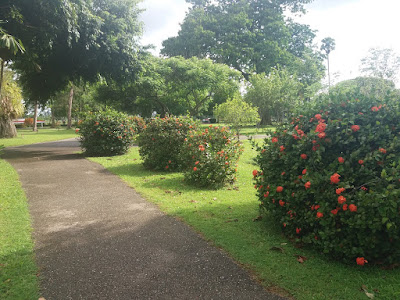
Of all places to go walking in Trinidad, the North Coast Road is my absolute favorite. Maybe it's because it's a scenic route, you pass three beaches on the way (Maracas Bay, Tyrico Bay and Las Cuevas Bay) as well as some of the best views of the Northern Range you can see (El Tucuche towers in the background).
Or maybe it's something about the sea breeze and the smell of the ocean in the air.
Maybe it's the anticipation of a Richard's Bake and Shark after the walk.
Whatever it is, it's the walk I enjoy the most.
The North Coast Road stretches from Maraval all the way to Blanchisseuse - a distance of some 31 km (19.2 miles).
No I do not walk from Maraval to Blanchisseuse.
I only walk the 5 miles between Maracas Bay and Las Cuevas Bay, and then back again...making it a total of 10 miles.
Today, I added another couple miles to it by venturing to Fort Abercromby, a short distance past Las Cuevas Bay.
This might be a walk near the beach but it is no walk in the park.
That stretch is undulating - steep in some parts where it feels like you're walking uphill, and then flat again, then downhill.
I hadn't done it in a while and quite forgot how difficult it was.
I started off running, feeling mehself, yassss ah could run.
The running didn't last very long.
Anyway, it took me an hour and 32 minutes to walk from Maracas to Las Cuevas. From Las Cuevas, it's just about another 15 minute walk to get to Fort Abercromby....or what remains of it.
It's just two rusty cannons left.

The Fort was built by the British in 1804 as part of a system of defenses that also included Fort George in St James.
The view from Las Cuevas made it the ideal spot to monitor ships coming to Trinidad from that direction.
Like Fort George, it never saw any real military activity.
As the story goes, England and France were at war and so when an officer saw ships approaching, he thought them to be French military ships launching an attack.
The officer quickly set fire to the huts, trained the cannons on the approaching ships and fled the Fort to carry the news of the impending attack.
It turned out he was mistaken and the approaching fleet belonged to the British.
Fort Abercromby was abandoned since that point.

It might be derelict and nowhere near as well maintained as Fort George, but the views are worth the short trek.
There are three main places where you can take in the views. From the cannons overlooking the sea or if you're adventurous, like me, you can climb down a steep, slippery rock formation that juts out over the greenest, most inviting water I've ever seen.


I wanted to jump in. But then I remembered I can't swim.
The third place you can go to take in the views is up a concrete stairway that takes you high above the Fort. I counted 109 steps to the top, which led to another short trail.

The return walk to Maracas took another hour and a half.
For some reason, every time I do this walk, rain falls. I was soaked right through by the time I got back. But I prefer the rain than hot sun!
Altogether, the walk was just over 12 miles...close to 20 km. Not bad. I will definitely be doing it again.
Length: 19.7 km total (12.2 miles) from Maracas Bay to Fort Abercromby and back.
Terrain: Paved road. Short dirt trail to the Fort.
Time: About 1 hr 30 minutes minutes one way, walking at a moderate pace.
Points to note: There are no pavements along this road and it sees quite a lot of traffic, so ya gotta be careful.
Also, monitor the news for any warnings of landslides along the North Coast Road.
Got any ideas of scenic places to walk or hike to? Comment any suggestions down below!
 |
| Trinidad's second tallest peak - El Tucuche. |
Or maybe it's something about the sea breeze and the smell of the ocean in the air.
Maybe it's the anticipation of a Richard's Bake and Shark after the walk.
Whatever it is, it's the walk I enjoy the most.
The North Coast Road stretches from Maraval all the way to Blanchisseuse - a distance of some 31 km (19.2 miles).
No I do not walk from Maraval to Blanchisseuse.
I only walk the 5 miles between Maracas Bay and Las Cuevas Bay, and then back again...making it a total of 10 miles.
Today, I added another couple miles to it by venturing to Fort Abercromby, a short distance past Las Cuevas Bay.
This might be a walk near the beach but it is no walk in the park.
That stretch is undulating - steep in some parts where it feels like you're walking uphill, and then flat again, then downhill.
I hadn't done it in a while and quite forgot how difficult it was.
I started off running, feeling mehself, yassss ah could run.
The running didn't last very long.
Anyway, it took me an hour and 32 minutes to walk from Maracas to Las Cuevas. From Las Cuevas, it's just about another 15 minute walk to get to Fort Abercromby....or what remains of it.
It's just two rusty cannons left.

The Fort was built by the British in 1804 as part of a system of defenses that also included Fort George in St James.
The view from Las Cuevas made it the ideal spot to monitor ships coming to Trinidad from that direction.
Like Fort George, it never saw any real military activity.
As the story goes, England and France were at war and so when an officer saw ships approaching, he thought them to be French military ships launching an attack.
The officer quickly set fire to the huts, trained the cannons on the approaching ships and fled the Fort to carry the news of the impending attack.
It turned out he was mistaken and the approaching fleet belonged to the British.
Fort Abercromby was abandoned since that point.

It might be derelict and nowhere near as well maintained as Fort George, but the views are worth the short trek.
There are three main places where you can take in the views. From the cannons overlooking the sea or if you're adventurous, like me, you can climb down a steep, slippery rock formation that juts out over the greenest, most inviting water I've ever seen.


I wanted to jump in. But then I remembered I can't swim.
The third place you can go to take in the views is up a concrete stairway that takes you high above the Fort. I counted 109 steps to the top, which led to another short trail.

The return walk to Maracas took another hour and a half.
For some reason, every time I do this walk, rain falls. I was soaked right through by the time I got back. But I prefer the rain than hot sun!
Altogether, the walk was just over 12 miles...close to 20 km. Not bad. I will definitely be doing it again.
Length: 19.7 km total (12.2 miles) from Maracas Bay to Fort Abercromby and back.
Terrain: Paved road. Short dirt trail to the Fort.
Time: About 1 hr 30 minutes minutes one way, walking at a moderate pace.
Points to note: There are no pavements along this road and it sees quite a lot of traffic, so ya gotta be careful.
Also, monitor the news for any warnings of landslides along the North Coast Road.
Got any ideas of scenic places to walk or hike to? Comment any suggestions down below!


Comments
Post a Comment