
Places to walk in Trinidad: Tucker Valley Road/Bamboo Cathedral
No place in Trinidad is quite as abundant in popular walking and hiking routes as the north-western peninsula.
You can walk the 8km hill to Mt St Catherine. Or take a scenic trek up to the historical Chaguaramas tracking station through Bamboo Cathedral. You can hike to the site of the 1975 plane crash. Or maybe trek to the Tucker Valley Arboretum. Or hike the Lumber Lane trail and see some relics left over from WWII.
Maybe you want to take a dip? In that case, Edith Falls might be right up your alley (visit in the rainy season though). Or if you want something a little more challenging, a hike to Covigne River Gorge will get your heart pumping.
Or if you're a little off your rocker and you want to engage in a hike from hell that will last upwards of 7 hours, you can hike from Macqueripe along the Morne Pierre ridge.
The list of places to walk or hike in Chaguaramas goes on and on and there's something for everybody.
And most of these places are well maintained by the Chaguaramas Development Authority (CDA).
So I find myself doing some trek or the other in this area whenever I have the time.
Well today I got time, cuz!

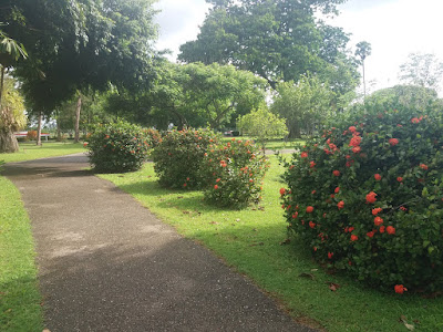
Today I walked the length of Tucker Valley Road from the entrance to Macqueripe Beach facility and back again. A distance of approximately 10km. From there, I went up to the tracking station just for the heck of it. And well, because I had time.
Tucker Valley Road is probably better known as "the Macqueripe stretch", at least that's what everybody I know calls it.
It's completely flat, no inclines and is about 5km one way.
I've walked this stretch a few times before.
Along the way there's a few interesting (and spooky) things to see.
Like the ruins of the Chapel of Saint Chad. In the chapel cemetery, several grave sites are still visible, which date back to the 1800s.
The most notable of these is the grave of Amelia Tripp, who was the daughter of William Tucker who owned the Tucker Valley estate (formerly known as La Cuesa Estate).
According to historian Angelo Bissessarsingh, Amelia married her father's business partner Edgar Tripp. She died in childbirth in 1879 at the age of 24.
It is said that her spirit haunts Tucker Valley Road. I know, I know. A bunch of baloney, right?
Still, there are those that claim to have seen Amelia's ghost late at night or in the wee hours of the morning. *rolls eyes vigorously*


Anyway, enough of that.
Among the other less spooky things to see on this stretch is the UPick Vegetable Farm, where you can pick produce fresh from the tree and purchase at reasonable prices.
It took me approximately an hour and 50 minutes to walk the length of Tucker Valley Road twice, at a leisurely pace. I had meant to jog to try to beat my previous time but my legs were still sore from yesterday's run/hike to Edith falls so I ended up just walking today.
By the time I got to Bamboo Cathedral, also called the Cazabon Trail, my ass was tired. Literally. I had a pain in my left butt cheek. But I was determined to make it to the tracking station. I struggled up the hill, stopped to rest a few times, but I made it all the same.
The trail to the tracking station is situated off Tucker Valley Road, just before you reach Macqueripe beach.
Bamboo Cathedral is a 300 metre stretch of paved road which leads to a steep 3.5 kilometre hill.
It gets its name from the bamboo plants that grow on either side of the stretch and form a perfect arch overhead.
You can walk the 8km hill to Mt St Catherine. Or take a scenic trek up to the historical Chaguaramas tracking station through Bamboo Cathedral. You can hike to the site of the 1975 plane crash. Or maybe trek to the Tucker Valley Arboretum. Or hike the Lumber Lane trail and see some relics left over from WWII.
 |
| Bamboo Cathedral |
Or if you're a little off your rocker and you want to engage in a hike from hell that will last upwards of 7 hours, you can hike from Macqueripe along the Morne Pierre ridge.
The list of places to walk or hike in Chaguaramas goes on and on and there's something for everybody.
And most of these places are well maintained by the Chaguaramas Development Authority (CDA).
So I find myself doing some trek or the other in this area whenever I have the time.
Well today I got time, cuz!

Today I walked the length of Tucker Valley Road from the entrance to Macqueripe Beach facility and back again. A distance of approximately 10km. From there, I went up to the tracking station just for the heck of it. And well, because I had time.
Tucker Valley Road is probably better known as "the Macqueripe stretch", at least that's what everybody I know calls it.
It's completely flat, no inclines and is about 5km one way.
I've walked this stretch a few times before.
Along the way there's a few interesting (and spooky) things to see.
Like the ruins of the Chapel of Saint Chad. In the chapel cemetery, several grave sites are still visible, which date back to the 1800s.
 |
| What's left of the Chapel of Saint Chad |
According to historian Angelo Bissessarsingh, Amelia married her father's business partner Edgar Tripp. She died in childbirth in 1879 at the age of 24.
It is said that her spirit haunts Tucker Valley Road. I know, I know. A bunch of baloney, right?
Still, there are those that claim to have seen Amelia's ghost late at night or in the wee hours of the morning. *rolls eyes vigorously*


Anyway, enough of that.
Among the other less spooky things to see on this stretch is the UPick Vegetable Farm, where you can pick produce fresh from the tree and purchase at reasonable prices.
It took me approximately an hour and 50 minutes to walk the length of Tucker Valley Road twice, at a leisurely pace. I had meant to jog to try to beat my previous time but my legs were still sore from yesterday's run/hike to Edith falls so I ended up just walking today.
By the time I got to Bamboo Cathedral, also called the Cazabon Trail, my ass was tired. Literally. I had a pain in my left butt cheek. But I was determined to make it to the tracking station. I struggled up the hill, stopped to rest a few times, but I made it all the same.
The trail to the tracking station is situated off Tucker Valley Road, just before you reach Macqueripe beach.
 |
| The Chaguaramas tracking station |
It gets its name from the bamboo plants that grow on either side of the stretch and form a perfect arch overhead.
Once you get to the end of that stretch, the bamboo gives way to thicker vegetation and the trek to go up the hill begins. The hill is about the same distance as Chancellor Hill, but considerably steeper.
Someone spray painted numbers on the roadway so you can use those as a marker to gauge just how much further you have to go. The numbers go up to 27.
Someone spray painted numbers on the roadway so you can use those as a marker to gauge just how much further you have to go. The numbers go up to 27.
At the top of the hill is the Chaguaramas missile tracking station, which was commissioned in 1959 and remained active until 1971.
The site has become dilapidated and has been vandalised and plastered with graffiti.


Length: 10.21 miles (16.43 km)
Terrain: Tucker Valley Road - Paved, flat road. There are no pavements and this road sees quite a bit of traffic so be cautious and keep to the side. The road to the tracking station starts flat and remains so for 300 meters. The remainder of this road is ALL uphill and all paved.
Time: 3 hours, 23 minutes
Got any ideas of scenic places to walk or hike to? Comment any suggestions down below!
The site has become dilapidated and has been vandalised and plastered with graffiti.
The entire trek came up to 10.21 miles (16.43km). That's the equivalent of walking from the Arima Velodrome to around Carib Brewery in St Joseph. Not bad.
Had to reset my tracker for the last two miles due to a glitch with my phone. So the reading came out in two parts.


The trek took me 3 hours and 23 minutes.
I didn't beat my previous time of 3 hours and 11 minutes but meh.
The race is not for the swift, but for those who endure until the end.
Length: 10.21 miles (16.43 km)
Terrain: Tucker Valley Road - Paved, flat road. There are no pavements and this road sees quite a bit of traffic so be cautious and keep to the side. The road to the tracking station starts flat and remains so for 300 meters. The remainder of this road is ALL uphill and all paved.
Time: 3 hours, 23 minutes
Got any ideas of scenic places to walk or hike to? Comment any suggestions down below!

Comments
Post a Comment