
1975 plane crash hike
Ever since I saw this story about the wreckage of a plane perched on the side of a mountain in Chaguaramas, I made it my duty to see it for myself.
And so the opportunity arose to hike to the spot today and even though I had already committed to doing a 5k race in the afternoon, I could not let this hike pass me by.
So along with a group from Hike Life Adventures, we set out around 6 am.
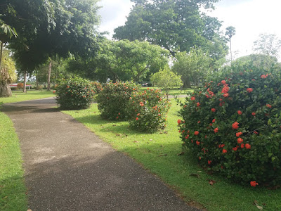
The first part of the hike is pretty simple. You take the same route to get to the tracking station in Macqueripe, through Bamboo Cathedral also known as Cazabon Trail.
This trail is situated off Tucker Valley Road, just before you reach Macqueripe beach.
Bamboo Cathedral is a 300 metre stretch of paved road which leads to a steep 3.5 kilometre hill.
It gets its name from the bamboo plants that grow on either side of the stretch and form a perfect arch overhead.

Once you get to the end of that stretch, the bamboo gives way to thicker vegetation and the trek to go up the hill begins. The hill is about the same distance as Chancellor Hill, but considerably steeper.
Someone spray painted numbers on the roadway so you can use those as a marker to gauge just how much further you have to go. The numbers go up to 27.

At the top of the hill is the Chaguaramas missile tracking station.
According to an article written by former energy Minister Kevin Ramnarine, the tracking station was part of a complex built by the American military when they occupied Chaguaramas.
The tracking station did what its name implies, it tracked missiles and satellites. It was commissioned in 1959 and remained active until 1971.
The site has become dilapidated and has been vandalised and plastered with graffiti. Some very...interesting...graffiti.


Nevertheless, the actual tracking dish is still standing. My photographer friend Kitty Kowlessar captured it perfectly.

I climbed up a portion of it since I saw photos of people standing inside the dish itself and I wanted to do the same. But it was too rickety and I've become quite attached to being alive. So I didn't go any further.

Anyway, the real hike begins at this point. There's a trail to the left that leads up the mountain where the remnants of the plane sits.
The trail itself is about a mile long. It is uphill all the way but thankfully, the incline is gentle and nowhere near as steep as Saut D'eau!
Along the trail we stopped to drink water from a water vine which I never even knew was a thing. But the water was better tasting than WASA own!


Coming to the end of the trail is where it gets tough. You have to go down the side of the mountain and it is everything you imagine going down the side of a mountain would be like. Our hike leader came prepared though. He expertly tied a rope to help us navigate the treacherous terrain. I still managed to land on my butt several times.
Y'all this plane is literally at an angle at the side of the mountain. It is a wonder it hasn't slid further down all these years.
Climbing down, gripping onto the rope, all I could think was dem pilot and dem couldn't find a flatter area to crash? For fuck's sake!
Anyway, we got to the wreckage which was pretty amazing to see.
The scores of visitors before us had scrawled their names on the body of the plane to show that they had came and conquered the trek. I did the same.


The history of the plane crash is a really sad story when you think of it. Nobody died, let's get that out of the way. The two pilots were the only occupants and they escaped with minor injuries. Thank goodness. However the plane itself was brand new. It was being delivered to its new owner in Brazil when the pilots encountered some bad weather, forcing them to crash land. And so a perfectly brand new plane found itself reduced to rubble and rust and something fascinating for hikers like me to gaze at. It really is a humbling thing to see. These pics were taken by Kitty Kowlessar.


Well, if going down the side of the mountain to get to the crash site was tough...hahahah. Coming back up it was quite the adventure. Woooiiiii. That's all I will say.
Once we got over that part though, the trek was all downhill from there to get back out to the tracking station and back out through Bamboo Cathedral to Tucker Valley Road.
The entire trip took us around five hours but this included rest breaks and the time we took to explore the abandoned buildings and whatnot.
Afterwards, Kitty and I went home to prepare for the UWI 5k race. My ass was so tired, I'm, pretty sure I clocked my worst 5k time ever. But at least we looked cute doing it.

Length: A grand total of 6.15 miles (almost 10 km) Although the Relive app says more, I trust Map My Walk when it comes to measuring distances.
Difficulty: Level 4
Terrain: Paved, hilly road leading to rocky, dirt trail through a densely forested area. Trees have fallen along the way so there are logs you must climb over.
Time: It took us 5 hours to complete including rest breaks.
Points to note: Wear long clothing that covers your arms and legs. I didn't do this and now I have new scars, scrapes and insect bites to show for my idiocy.

Got any ideas of scenic places to walk or hike to? Comment any suggestions down below!
And so the opportunity arose to hike to the spot today and even though I had already committed to doing a 5k race in the afternoon, I could not let this hike pass me by.
So along with a group from Hike Life Adventures, we set out around 6 am.
The first part of the hike is pretty simple. You take the same route to get to the tracking station in Macqueripe, through Bamboo Cathedral also known as Cazabon Trail.
This trail is situated off Tucker Valley Road, just before you reach Macqueripe beach.
Bamboo Cathedral is a 300 metre stretch of paved road which leads to a steep 3.5 kilometre hill.
It gets its name from the bamboo plants that grow on either side of the stretch and form a perfect arch overhead.

Once you get to the end of that stretch, the bamboo gives way to thicker vegetation and the trek to go up the hill begins. The hill is about the same distance as Chancellor Hill, but considerably steeper.
Someone spray painted numbers on the roadway so you can use those as a marker to gauge just how much further you have to go. The numbers go up to 27.

At the top of the hill is the Chaguaramas missile tracking station.
According to an article written by former energy Minister Kevin Ramnarine, the tracking station was part of a complex built by the American military when they occupied Chaguaramas.
The tracking station did what its name implies, it tracked missiles and satellites. It was commissioned in 1959 and remained active until 1971.
The site has become dilapidated and has been vandalised and plastered with graffiti. Some very...interesting...graffiti.


I climbed up a portion of it since I saw photos of people standing inside the dish itself and I wanted to do the same. But it was too rickety and I've become quite attached to being alive. So I didn't go any further.

Anyway, the real hike begins at this point. There's a trail to the left that leads up the mountain where the remnants of the plane sits.
The trail itself is about a mile long. It is uphill all the way but thankfully, the incline is gentle and nowhere near as steep as Saut D'eau!
Along the trail we stopped to drink water from a water vine which I never even knew was a thing. But the water was better tasting than WASA own!


Coming to the end of the trail is where it gets tough. You have to go down the side of the mountain and it is everything you imagine going down the side of a mountain would be like. Our hike leader came prepared though. He expertly tied a rope to help us navigate the treacherous terrain. I still managed to land on my butt several times.
Y'all this plane is literally at an angle at the side of the mountain. It is a wonder it hasn't slid further down all these years.
Climbing down, gripping onto the rope, all I could think was dem pilot and dem couldn't find a flatter area to crash? For fuck's sake!
Anyway, we got to the wreckage which was pretty amazing to see.
The scores of visitors before us had scrawled their names on the body of the plane to show that they had came and conquered the trek. I did the same.


Well, if going down the side of the mountain to get to the crash site was tough...hahahah. Coming back up it was quite the adventure. Woooiiiii. That's all I will say.
Once we got over that part though, the trek was all downhill from there to get back out to the tracking station and back out through Bamboo Cathedral to Tucker Valley Road.
The entire trip took us around five hours but this included rest breaks and the time we took to explore the abandoned buildings and whatnot.
Afterwards, Kitty and I went home to prepare for the UWI 5k race. My ass was so tired, I'm, pretty sure I clocked my worst 5k time ever. But at least we looked cute doing it.

Length: A grand total of 6.15 miles (almost 10 km) Although the Relive app says more, I trust Map My Walk when it comes to measuring distances.
Difficulty: Level 4
Terrain: Paved, hilly road leading to rocky, dirt trail through a densely forested area. Trees have fallen along the way so there are logs you must climb over.
Time: It took us 5 hours to complete including rest breaks.
Points to note: Wear long clothing that covers your arms and legs. I didn't do this and now I have new scars, scrapes and insect bites to show for my idiocy.

Got any ideas of scenic places to walk or hike to? Comment any suggestions down below!


Thanks for this. I was looking for a comparison between the tracking station walk and chancellor hill...you did that for me nicely. Thanks
ReplyDelete